
Seven smart ways to track urban invasive birds include: Bluetooth Low Energy beacons that offer long battery life, citizen science mobile apps for community reporting, GPS and radio-frequency tags for precise location data, urban camera networks with image recognition, environmental DNA sampling from the environment, acoustic monitoring that captures distinctive calls, and social media data mining of public sightings. These innovative techniques help you monitor populations more effectively than traditional methods alone. Discover how these approaches are revolutionizing urban bird management.
Bluetooth Low Energy (BLE) Tracking Systems
Technological innovation has transformed urban bird monitoring through Bluetooth Low Energy (BLE) beacons. These lightweight devices weigh just 5-6 grams and cost around $7 USD per unit, making them ideal for tracking smaller invasive bird species in urban environments.
You’ll benefit from BLE beacons’ high-frequency tracking capabilities, allowing you to construct detailed home ranges and detect when and where invasive birds interact. With battery life spanning 1-3 years, you won’t need frequent replacements during long-term studies.
BLE technology’s greatest advantage comes from its compatibility with Apple’s Find My network, providing real-time position updates in populated areas. This hybrid approach combines passive and active tracking benefits, creating a scalable solution that addresses limitations in traditional monitoring methods for urban ecology research.
Citizen Science Mobile Applications
While advanced tracking technologies provide valuable scientific data, citizen science mobile applications have democratized invasive bird monitoring by engaging urban residents directly in the process.
Apps like MISIN allow you to become citizen scientists by simply snapping photos and logging sightings of invasive birds from your smartphone.
Your contributions make a real difference:
Every observation you submit creates ripples in conservation science—your everyday sightings become tomorrow’s research breakthroughs.
- You can collect data on location, time, and abundance that helps researchers map invasive species spread.
- Your participation joins thousands of others—one study gathered over 14,700 valid records of sulphur-crested cockatoos.
- The information you provide integrates with broader research efforts, connecting citizens with conservationists.
These apps also serve as educational tools, empowering you to identify invasive species while actively participating in local conservation initiatives.
GPS and Radio-frequency Tagging
Beyond citizen participation, professional researchers rely on GPS and radio-frequency tagging to gather precise data on invasive bird movements. When you’re tracking urban invasive species, these traditional methods offer detailed insights but come with limitations.
| Method | Advantages | Limitations |
|---|---|---|
| GPS Tagging | Precise location data | High cost per bird |
| VHF Radio Tags | Real-time tracking | Limited by researcher availability |
| BLE Beacons | More scalable solution | Newer technology |
| Livestock Ear-Tags | 95% retention rate | Alternative option |
| Traditional Methods | Valuable movement data | Struggle with large populations |
While GPS tagging birds provides thorough movement patterns, you’ll find it difficult to monitor large populations simultaneously due to cost constraints. Radio-frequency methods offer good tracking capabilities but require significant time investment. For urban invasive bird monitoring, consider complementing these approaches with newer, more scalable technologies.
Urban Camera Networks and Image Recognition
As cities expand their surveillance infrastructure, urban camera networks have emerged as powerful tools for monitoring invasive bird populations at scale.
You’ll find these systems strategically positioned across urban areas, continuously capturing valuable footage that reveals how invasive species move and behave in real-time.
Advanced image recognition algorithms paired with machine learning analyze this data with increasing accuracy over time, identifying birds by their unique physical features and behavioral patterns.
- Widespread coverage – networks monitor multiple locations simultaneously, tracking invasive species spread
- Continuous learning – systems become more accurate as they process new inputs
- Actionable insights – collected data directly informs conservation strategies and management decisions
This technology provides extensive monitoring without the limitations of traditional tracking methods, giving you unprecedented visibility into invasive bird activities across entire metropolitan landscapes.
Environmental DNA (eDNA) Detection Methods

Unlike traditional bird monitoring approaches, environmental DNA detection methods have revolutionized how researchers track invasive species in urban settings. When you collect soil or water samples from city environments, you’re gathering genetic traces that urban birds leave behind.
PCR techniques amplify these DNA fragments, allowing detection of species like the Eurasian collared dove even when birds aren’t directly observed.
The beauty of eDNA sampling is its non-invasive nature—you won’t disturb wildlife or urban residents during monitoring activities.
What makes this method particularly valuable is its sensitivity. You can identify invasive species at lower population densities than with conventional surveys, enabling earlier detection before problems escalate.
This gives city managers precious time to implement control measures when invasions are still manageable, making eDNA an essential tool in urban bird management.
Acoustic Monitoring and Sound Pattern Analysis
While eDNA methods capture genetic footprints, sound offers another powerful dimension for tracking urban invaders. You’ll find acoustic monitoring particularly effective for urban birds that produce species-specific nocturnal flight calls. Using software like BirdVoxDetect, researchers can identify and classify invasive species even when visual observation isn’t possible.
- Advanced machine learning algorithms now analyze vast acoustic datasets, processing over 6,671 hours of recordings that identified 233,124 flight calls.
- Acoustic monitoring overcomes limitations of traditional GPS tagging and Doppler radar methods in complex urban environments.
- Deploying inexpensive microphones throughout cities creates extensive monitoring networks that reveal behavior patterns invisible to other tracking methods.
This technology opens new windows into nocturnal bird movements and interactions, providing critical data for managing invasive populations where traditional approaches fall short.
Social Media Data Mining for Bird Sightings
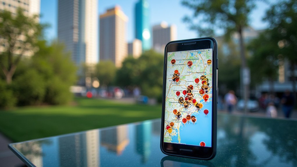
You’ll find robust citizen science platforms like iNaturalist and eBird transforming how researchers collect invasive bird data through social media engagement.
These platforms enable you to contribute sightings while automatically tagging location coordinates that researchers can analyze collectively.
The resulting location data visualizations reveal migration patterns, population density hotspots, and expansion trajectories of invasive species across urban landscapes.
Citizen Science Platforms
As mobile technology becomes increasingly integrated into daily life, citizen science platforms have emerged as powerful tools for tracking urban invasive birds. You’ll find dedicated apps and interactive websites that make data collection simple and engaging while contributing to essential conservation efforts.
Studies show these platforms can generate impressive results, like the sulphur-crested cockatoo project that gathered over 14,705 valid records.
Participating in urban bird tracking offers you:
- Real-time impact – Your sightings immediately contribute to scientific understanding of invasive species movements
- Community connection – Join thousands of fellow citizen scientists sharing observations
- Enhanced awareness – Develop a deeper appreciation for urban wildlife dynamics in your own neighborhood
These platforms transform casual observations into valuable scientific data through the power of community engagement.
Location Data Visualization
Beyond citizen science platforms, social media has revolutionized how researchers track and visualize urban invasive birds. When you share a bird sighting on platforms like Twitter or Instagram, you’re contributing valuable location data that helps scientists map species distribution in real-time.
Researchers now employ sophisticated data mining techniques to extract geospatial information from your posts, transforming casual observations into powerful visualization tools. These visualizations reveal patterns in bird behavior and habitat preferences across urban landscapes.
You’ll find that customized smartphone apps make this process even more efficient, with built-in geolocation features that enhance data accuracy.
The resulting visual maps don’t just track birds—they identify invasion hotspots, predict movement patterns, and inform targeted conservation strategies, all while making complex location data accessible and meaningful.
Frequently Asked Questions
How Do Scientists Track Migrating Birds?
Scientists track migrating birds by using acoustic monitoring systems to record nocturnal flight calls, GPS tagging, Doppler radar, and specialized software like BirdVoxDetect that employs neural networks to analyze audio data.
How Do You Control Invasive Birds?
You can control invasive birds through habitat modification, exclusion methods like nets, and deterrents. Partner with wildlife experts, track population changes, and educate your community about humane management strategies for long-term effectiveness.
How Are Bird Populations Tracked?
You’ll find bird populations are tracked through acoustic monitoring, BLE beacons, and citizen science apps. Researchers also use traditional methods like GPS tagging and Doppler radar to study migration patterns and habitat use.
Is There a Bird Tracker?
Yes, you’ll find several bird trackers available. You can use BirdVoxDetect software, attach BLE beacons to birds, or participate in citizen science apps that track bird populations through community sightings and reports.
In Summary
From high-tech BLE systems to citizen science apps, you’ll find numerous ways to monitor invasive birds in your city. Whether you’re attaching GPS tags, analyzing eDNA samples, or mining social media data, each method offers unique insights into urban avian invaders. By combining these seven tracking approaches, you’re not just gathering valuable data—you’re contributing to conservation efforts that help maintain ecological balance in our increasingly urbanized world.


Leave a Reply